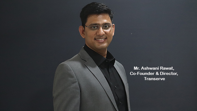
Transerve offers map platform for visualizing analysis on geo-spatial data. It helps in deploying customized applications for asset tracking/ mapping, monitoring of projects, spatial data collection with geo-tagged pictures and videos and to share maps with key stakeholders or public. In an exclusive interview with Manoj Jha, Editor, Smart State India, Mr. Ashwani Rawat, Co-Founder & Director, Transerve shares how his company enabling Smart City mission through geospatial platform and future initiatives of other sectors.
How Transerve Technologies enabling Smart City mission through geospatial platform?
At Transerve we are focusing on strengthening urban local bodies by setting up Municipal GIS and integrating it with e-governance modules. Our technology has helped cities manage their assets and operations to provide better citizen services and helps them evaluate the city’s progress and development using liveability indicators across 21 areas including the environment, slum rehabilitation, property tax, utilities, assets, disaster management, estate management, parks, roads and more. Our platform also helps ULBs to enhance the property tax collection using technologies like GIS and machine learning.
Could you brief up the flagship products and services of Transerve Technologies?
Our flagship platform Transerve Online Stack (TOS) has helped enterprises in solving a variety of pressing socio-urban issues while enabling smart-governance in revenue collection, water, and sanitation optimisation, app-based citizen portals, spatial analytics, and utility management to name a few.
Modules for different functions of urban local bodies can be developed on top of TOS. One such module is CityOS which is used for collecting property data from field using mobile devices and help ULBs in enhancing the efficiency of tax collection. TOS comes loaded with Machine Learning and GIS capabilities to enhance user experience and allow city administrator to visualize city performance over the map or custom dashboards.
Recently, you have launched a solution, Transerve Online Stack, to map COVID-19 density zones using geospatial technology. What are the ideas behind it?
Transerve Online Stack is a spatial analytics platform that presents a refreshingly simple approach to publishing spatial content and builds applications around it. The platform also supports mobile application which can used for democratized data collection from the ground over a large geography. We have opened the platform for the government to demarcate containment zones which can be used to monitor the movement in and out of the zone.
 The system works on predictive analysis and uses layers of geospatial data to track, monitor, analyse and visually represent them into data stacks. These data stacks help in route optimisation in COVID positive zones that can further assist businesses in making statistically driven decisions.
The spread of COVID-19 and extended lockdown impacted the Small and Medium Businesses along with large corporations alike. A downward trend was noticed across sectors, be it manufacturing, retail, e-commerce and travel and tourism. Considering this, we thought of a solution that can help businesses get back on track with their operations. This is extremely beneficial for large and medium retailers that are dependent on location to decide which outlet to open and which ones not to open. Similarly, large manufacturers also require geospatial data to analyse their supplier’s catchment area and plan their sourcing strategies accordingly. In fact, supply chain professionals and logistics companies too can use this solution for route optimisation.
Which are the major technologies deployed by Transerve and how are those creating an impact on the Smart City projects?
We are implementing CityOS in four cities of Uttar Pradesh – Aligarh, Bareilly, Moradabad and Saharanpur. The solution intends to help these cities to create baseline data for enhancing the revenue for ULBs and providing basic civic services to citizens. Our solutions are customised for India and have been developed considering the modular and scalable nature of the platform. The platform is developed on MEAN stack with NUIS architecture which is promoted by MoHUA. It is based on microservices and helps cities in creating Integrated Urban Data Exchange bases to collaborate with various departments in order to build data exchange harmony.
What are your future plans for other sectors?
We will be shortly releasing an unified urban platform covering the entire urban landscape. It will utilise open standards with an intention to offer a non-proprietary platform that can be used by all. As part of its ongoing projects, Transerve is implementing its City Scope solution which is co-developed by MIT, USA and University of Hamburg, Germany. The tool will help governments in planning the city and will assist in decision making. Currently, its execution is on-going in Bhubaneswar, in Odisha.


